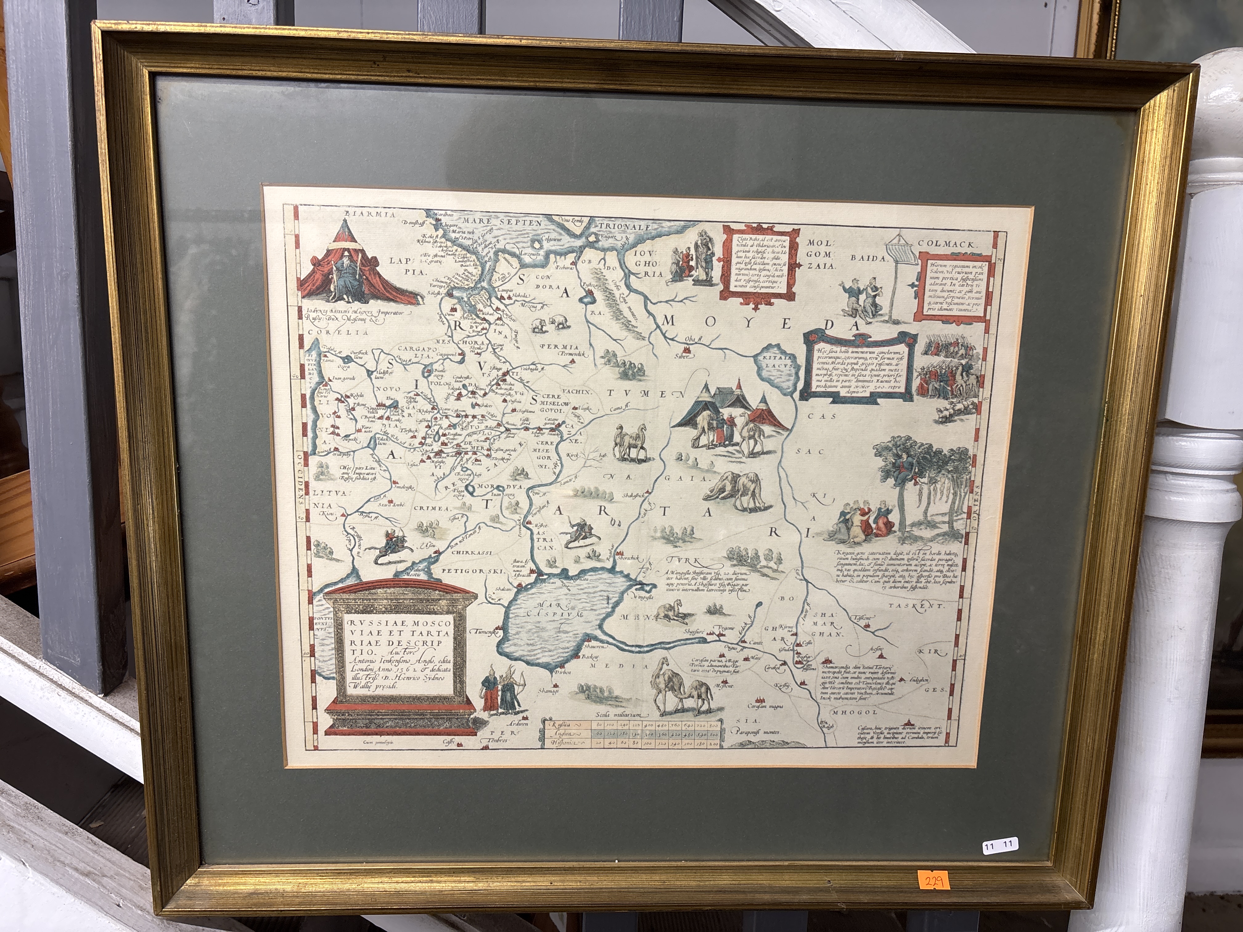
Lot 229: Abraham Ortelius, after Anthony Jenkinson, Russiae, Moscoviae et Tartariae Descriptio Map
A hand-coloured copperplate engraving on paper titled RVSSIAE, MOSCOVIAE ET TARTARIAE DESCRIPTIO, providing a description of Russia, Muscovy, and Tartary. This map is based on the 1562 original by the English explorer Anthony Jenkinson and was published in various editions of Abraham Ortelius’s Theatrum Orbis Terrarum during the late 16th and early 17th centuries. The decorative cartouche in the lower-left corner contains the following transcription: RVSSIAE, MOSCO VIAE ET TARTA RIAE DESCRIP TIO. Auctore Antonio Ienkenfono Anglo, edita Londini Anno 1562. & dedicata illustriss. D. Henrico Sydneo Wallie praesidi. The map depicts Russia and surrounding regions including parts of Scandinavia, Central Asia, and the Caspian Sea, showing geographical features such as the Volga and Don rivers. The work is richly illustrated with numerous historical and ethnographic vignettes, including an enthroned figure of the Emperor of Russia beneath a red canopy, nomadic encampments with tents and figures in traditional dress, and livestock including camels and horses. Other scenes include figures kneeling before a tree, an army in formation, and various sea monsters and a sailing vessel in the sea areas. Regional names such as BIARMIA, PERMIA, TARTARIA, and TURKMEN are clearly marked. A scale of miles is located in the lower-centre, and several descriptive text blocks in Latin are set within decorative frames. The map is housed in a gilt-wood frame with a sage green mount and is glazed.
Condition report:
The print is in generally good condition with vibrant hand-colouring. There is a visible vertical centre fold and several horizontal folds, consistent with the map having been bound into an atlas. Minor areas of light foxing and age-toning are visible to the paper, particularly near the edges. The item has not been examined out of the frame. The gilt-wood frame shows minor wear consistent with age and handling, and includes two small adhesive lot stickers to the lower-right corner and bottom edge.
Share this lot: