

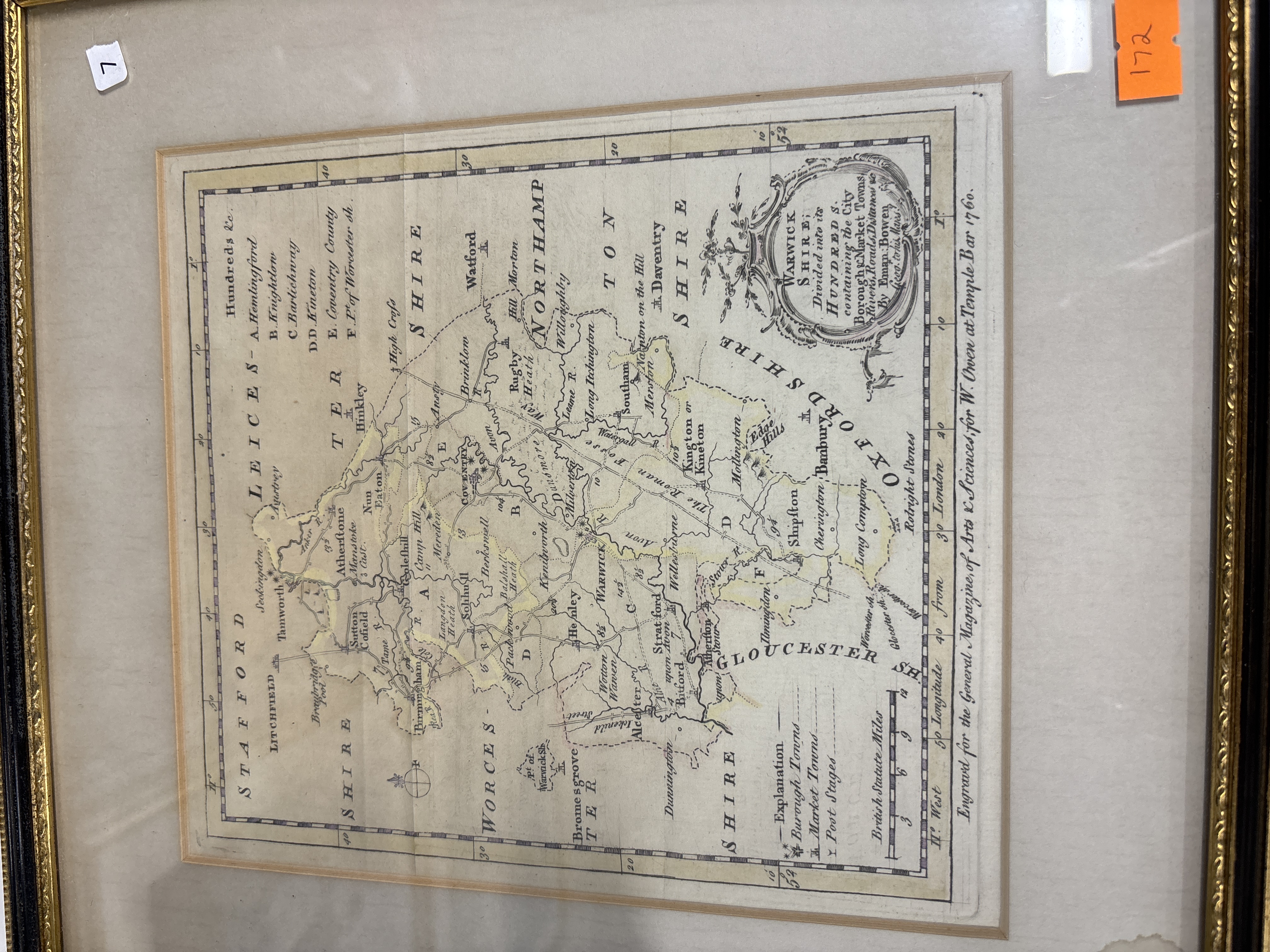
Lot 172: An Eighteenth Century Hand-Coloured Map of Warwickshire by Emanuel Bowen, dated 1760
A mid-eighteenth century copperplate engraved map of Warwickshire, printed on paper with hand-coloured outlines. The map depicts the county divided into its historical administrative hundreds, featuring major towns including Warwick, Coventry, Birmingham, and Stratford-upon-Avon. It includes a detailed network of roads with distances, rivers, and topographical features. In the upper right corner, an ornate rococo-style title cartouche is inscribed WARWICK SHIRE; Divided into its HUNDREDS; containing the City Borough & Market Towns, Rivers, Roads, Distances &c. By Eman: Bowen Geog. to his Majy. A bottom margin inscription reads Engravd for the General Magazine of Arts & Sciences, for W. Owen at Temple Bar 1760. The lower right section contains an Explanation key for identifying borough towns, market towns, and post stages, alongside a scale of British Statute Miles. The map is set within a gilt-finished wood frame behind glass. Two adhesive labels are present on the glass: a small white label with the number 7 in the upper left and a larger orange label with the number 172 in the upper right.
Condition report:
The map exhibits a prominent vertical centrefold as originally issued in the publication (photo 1). The paper shows light overall toning consistent with age, and there are scattered brown foxing spots and minor staining visible across the map area and margins (photo 1). The hand-applied colour remains relatively bright along the hundred borders. The gilt frame shows minor abrasions and surface wear to the edges and corners. There are no visible tears or significant paper losses apparent to the map surface.
Share this lot: