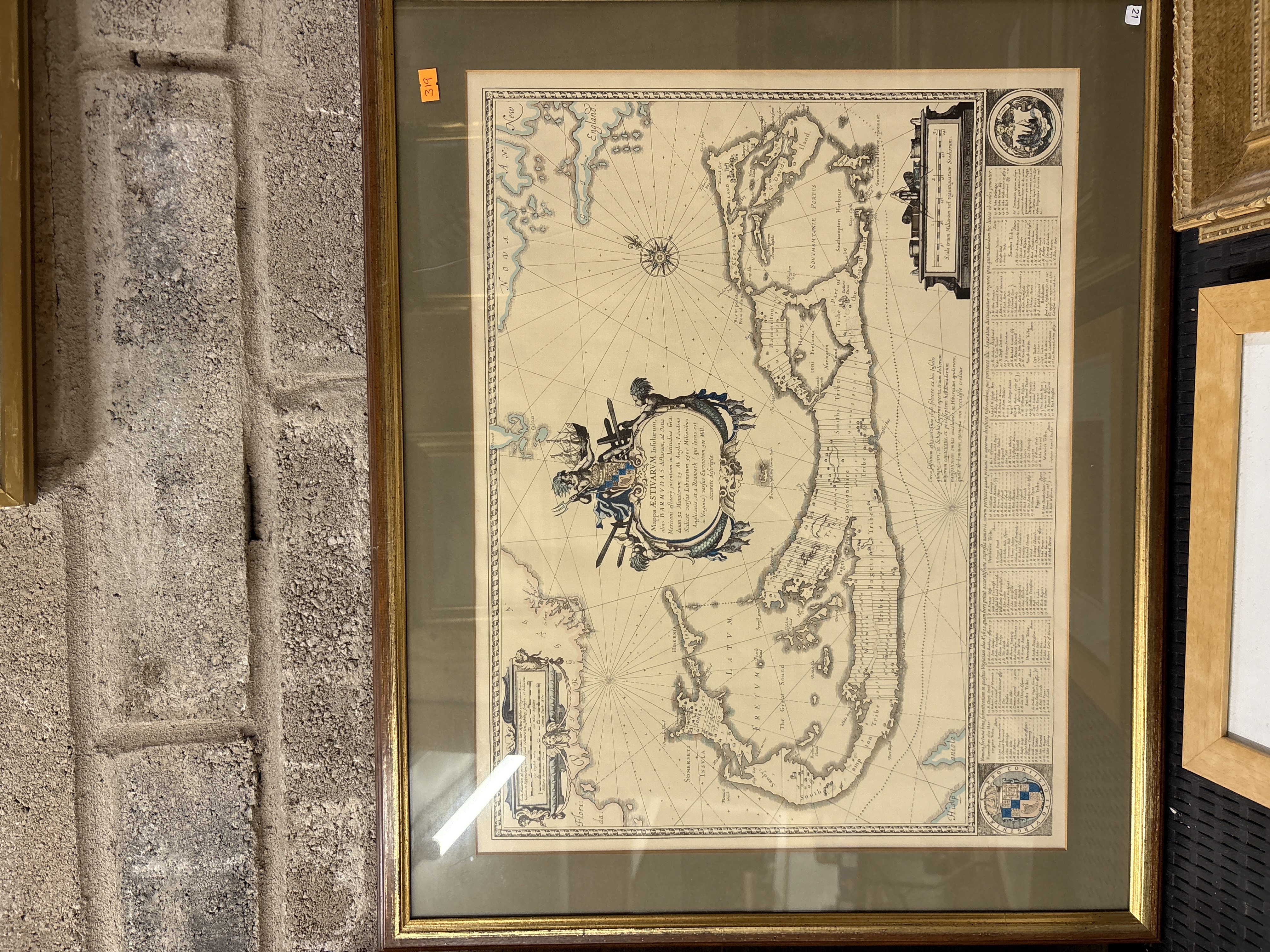
Lot 319: Willem Blaeu, A 17th-Century Hand-Coloured Engraved Map of Bermuda, Mappa Aestivarum Insularum, c.1630
A 17th-century hand-coloured copperplate engraved map of Bermuda by the Dutch cartographer Willem Janszoon Blaeu (1571–1638), titled Mappa Aestivarum Insularum, alias Barmudas dictarum. This landmark map is based on the 1616 survey by Richard Norwood and depicts the island divided into the eight original tribes or parishes and public lands, each numbered and referenced to the table below. The map features a large ornate title cartouche at the centre-left decorated with figures and navigational instruments. A secondary inset map at the bottom left illustrates Bermuda’s geographic position in relation to the North American coastline, spanning from La Florida and Virginia to New England. At the top right, a circular inset portrays wild hogs, an early emblem of the islands, while the bottom right corner contains the seal of the Bermuda Company with the motto PRO CONCILIO VIRGINIAE. An extensive Latin table of original landholders and adventurers is positioned beneath the map area. The work is finished with hand-coloured highlights to the coastal outlines, cartouches, and boundaries. An imprint is visible below the scale bar at the top right: Amstelodami, Guiljelm. Blaeuw excudit. The map is presented in a modern gilt-wood frame with a green mount and is glazed.
Condition report:
The paper shows general age-toning and overall browning consistent with age. A prominent central vertical fold is present as issued. Light scattered foxing and minor spotting are visible across the field. The map is housed in a modern frame and has not been examined out of the frame; however, there is no evidence of major tears or significant losses to the printed surface. Auction stickers are present on the glass and frame.
Share this lot: