
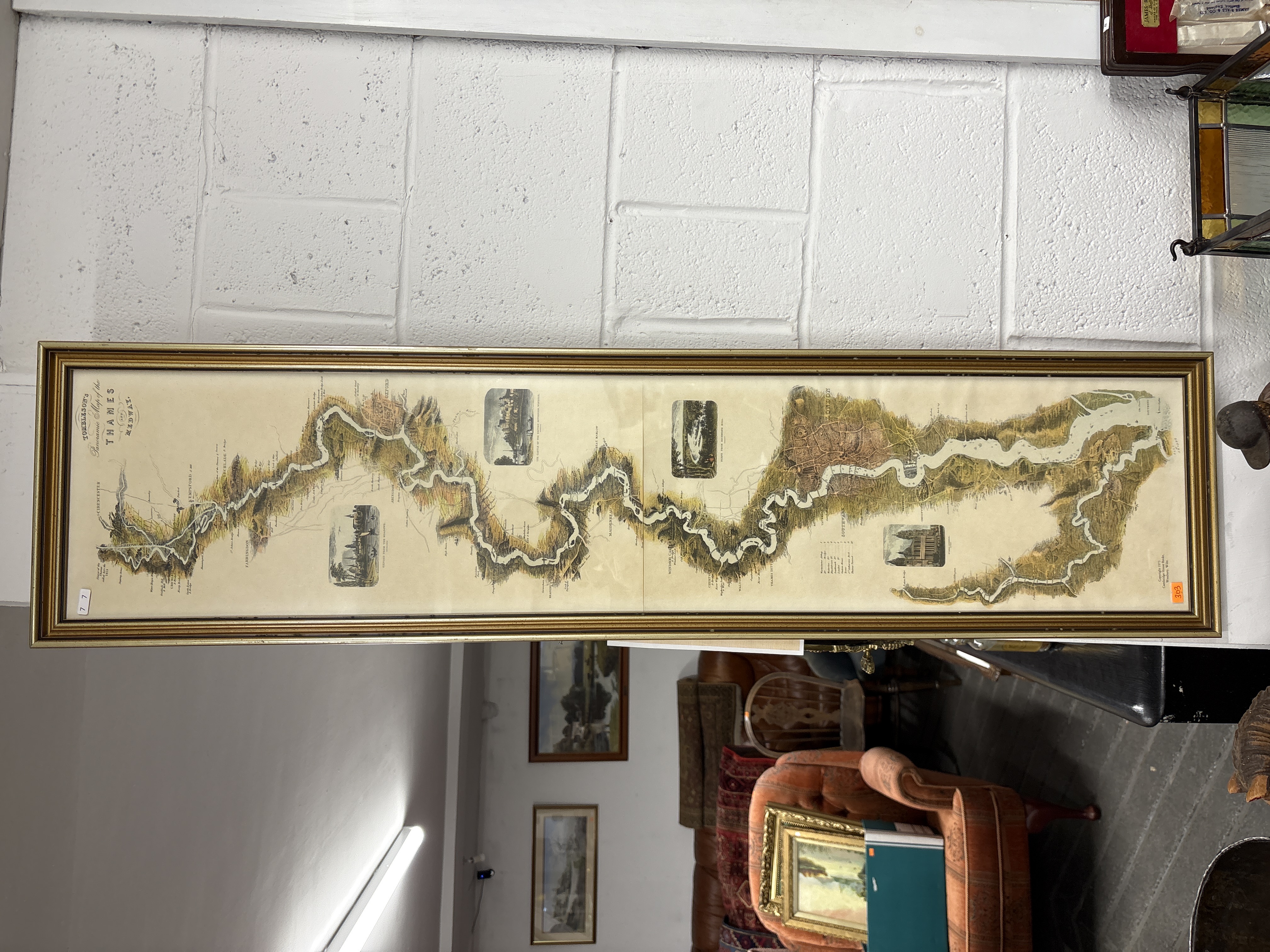
Lot 303: Tombleson's Panoramic Map of the Thames and Medway
A framed panoramic map after William Tombleson, titled Tombleson’s Panoramic Map of the Thames and Medway. The map illustrates the winding course of the River Thames and its surroundings, featuring detailed cartography and topographical information. The work includes several small vignette illustrations of landmarks and towns situated along the riverbanks, alongside a decorative title cartouche in the upper left section. The map is printed on paper and displays characteristic vertical fold lines. It is housed in a long, rectangular gilded wood frame behind glass.
93cm x 26cm
Condition report:
The item is in overall good condition. Visible vertical fold lines are present, which are typical for large-scale maps of this period. The paper shows no significant visible damage or heavy foxing. The gilded frame exhibits minor surface wear consistent with age.
Share this lot: