
Lot 242: The Fir Tree Aerial Map of the Lake District by Richard Chandler
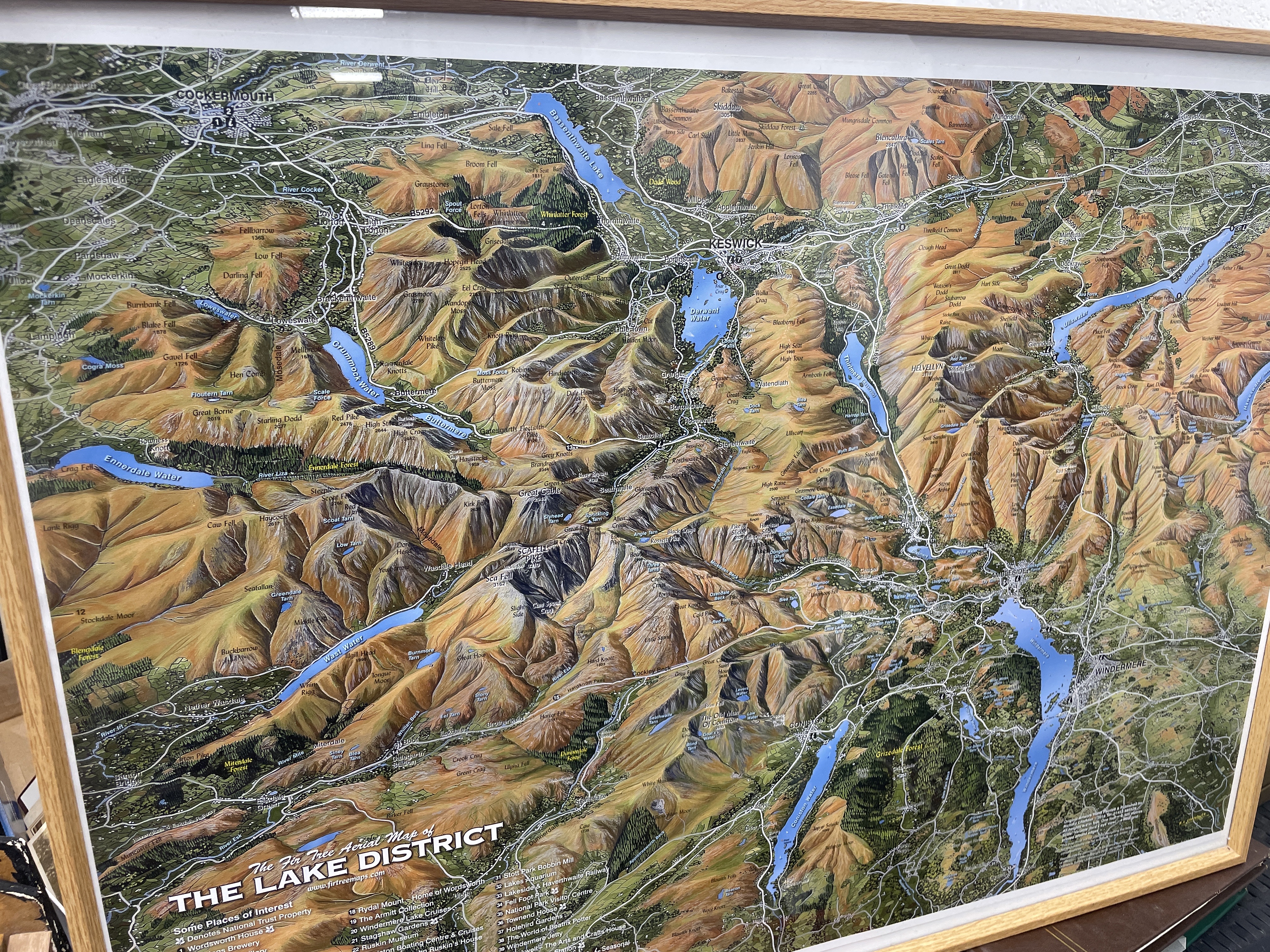
A framed panoramic map titled The Fir Tree Aerial Map of the Lake District, published by Fir Tree Maps. This stylized oblique-view topographic representation of the English Lake District National Park was created by Richard Chandler. The map displays major geographical features, including fells such as Scafell Pike and Skiddaw, and lakes including Windermere, Coniston Water, and Derwent Water. Regional towns such as Keswick, Ambleside, and Cockermouth are labeled. The lower margin contains a numbered legend for Some Places of Interest and the publisher’s website. The print is presented behind glass within a light-toned wooden frame.
Share this lot: